MapInfo Pro

Solution for advanced geographic data analysis

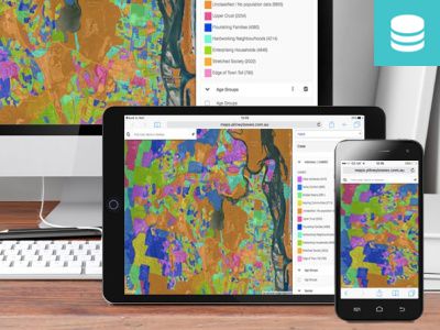
Discover new opportunities with MapInfo Pro, a powerful mapping and geographic analysis application designed to show the relationship between data and geography in a more visual way. See patterns and trends more easily with detailed maps and graphics, enabling you to make more informed decisions and capitalize on untapped business opportunities.

MapInfo Pro
Easy to use

MapInfo Pro is extremely flexible and can be easily integrated with your current IT systems. It is also extremely user-friendly so you don’t need to be an IT expert to use it.

Data access
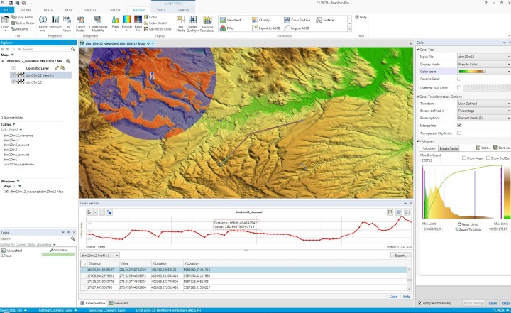
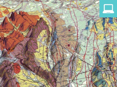
Software supports a range of data formats including many common PC file formats (such as Microsoft Excel, Access, DBF and CSV files), relational and spatial database formats (Oracle, Microsoft SQL Server, PostGIS, SQLite and ODBC compliant databases), and spatial data formats ( AutoCAD DXF/DWG, SHP, DGN and more).You can also use imagery (aerial images, satellite images, scanned paper maps, etc.) of almost any format in your maps. And MapInfo Pro includes access to Microsoft Bing aerial and hybrid maps as part of your software maintenance agreement.
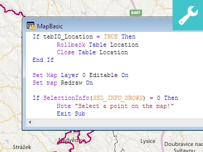
Data creation and editing
With MapInfo Pro you can access a vast selection of CAD data creation and editing tools as well as edit tabular data like values and names. Program allows you to make changes to all your maps and data in a single application, saving you time and effort.
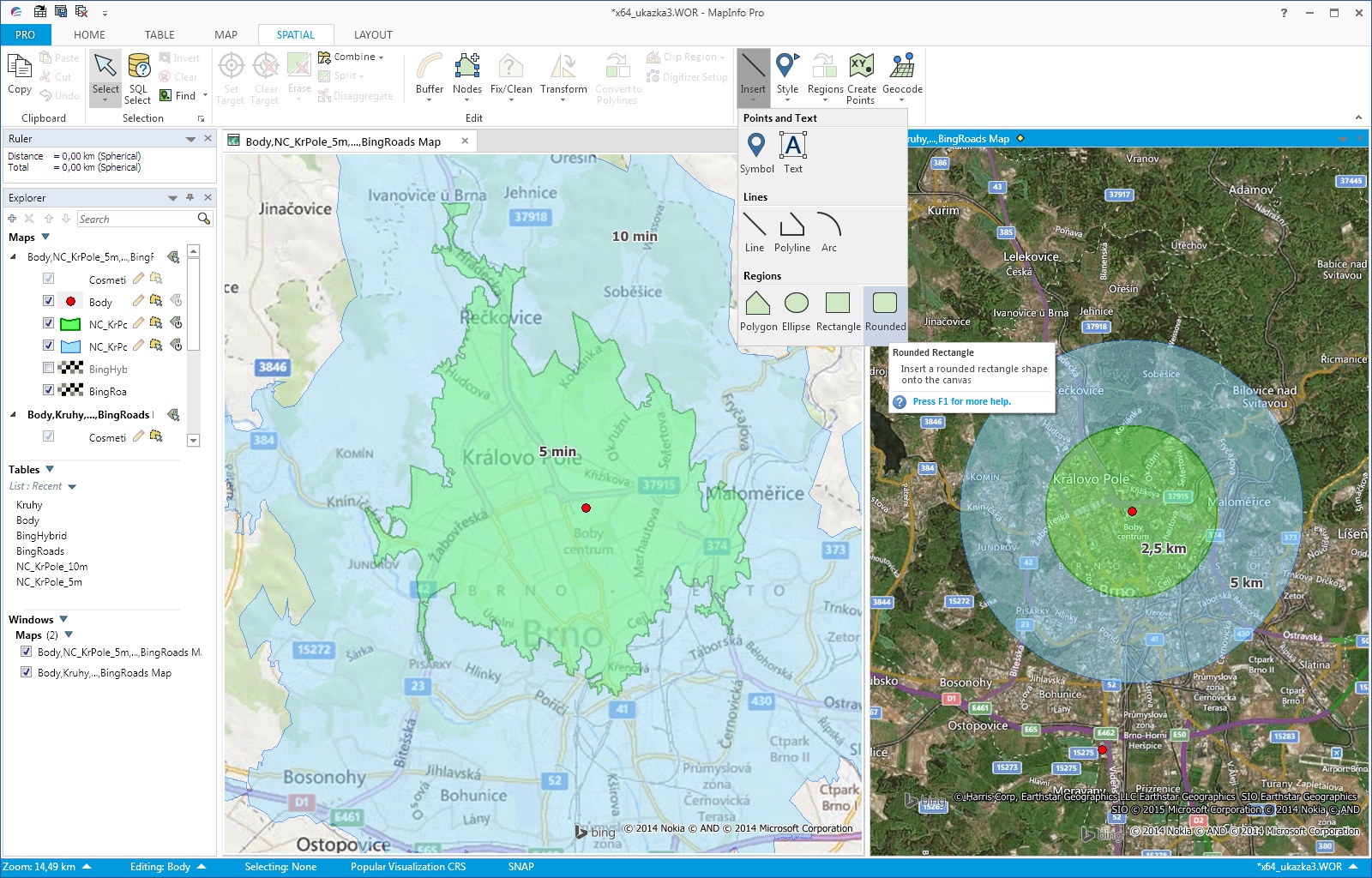
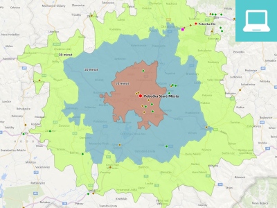
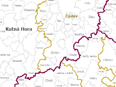
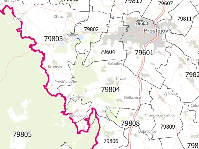
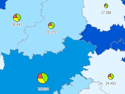
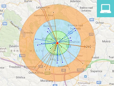
Map display and visualisation
MapInfo Pro simple-to-use map display wizards and detailed customisation options allow users of all skill levels to create great looking maps quickly. Load image datasets as background mapping and overlay your point, line and polygon data to visualise your data in the way you want. Change the style and appearance of any dataset using our powerful analytical processes and display customisation techniques.
Professional output
In the Layout window you can prepare professional map output. Resulting map can be saved as an image or as a layered PDF file.

Versions

MapInfo Pro

The standard version of MapInfo Pro uses a 64-bit architecture, the user interface is modern and easy to learn. This version contains most commonly used functionality, such as access to a variety of data and map formats, creating thematic maps, SQL queries, editing functions, regions redistricting, exporting maps and data, table structure management etc. This version contains also a number pre-installed add-on tools such as MapCAD, Distance Calculator, Spider Graph and many more. This is the most commonly used version of the application.

MapInfo Pro 64-bit

User interface corresponds with world leading software vendors. All functions are organized in tabs on the main ribbon.

MapInfo Pro 64-bit

Brief and complete help is available for beginners. Experienced users can save time with keyboard shortcuts.

MapInfo Pro Advanced

MapInfo Pro™ Advanced builds on MapInfo Pro™ introducing a highly performant raster grid analysis solution, featuring an innovative grid data format called Multi-Resolution Raster (MRR). It enables the super-fast processing, visualization and analysis of high resolution grid and image data; providing a step change in performance and usability even when working at a continental or global scale.

More information
MapInfo Pro Advanced

MapInfo Pro Viewer

MapInfo Viewer is a free application that allows users to work with workspaces that have been created in the full version of MapInfo Pro. Free registration of the user account is required to use the application. MapInfo Viewer (since version 17.0.2) is based on the same code as the full version of MapInfo Pro, so the user interface is the same. Map compositions can be viewed, users can save maps to PDF/images, Layer Control allows to switch on/off the layers etc.

More information
MapInfo Pro Viewer

Specification

Functions

MapInfo Pro is Precisely's key desktop product for spatial analysis. Dozens of programmers have been involved in its development for more than 30 years. Through its suggestions and comments, a number of partners and hundreds of thousands of program users around the world are also involved in the development process.

The result is a wide range of functionality, especially in the field of analysis, editing, access to source data and also in creating professional output.

Data import
  • Direct reading of Microsoft Excel, Access, dBASE, ASCII, CSV, SQLite database or ESRI Shapefile.
  • Import of other formats (DWG/DXF, DGN v7 and v8, KML, VPF and more).
  • Dozens of raster and grid formats supported.
  • Database access via ODBC (Oracle, MS SQL Server, IBM DB2, Sybase and more).
Data analysis
  • SQL queries and spatial queries.
  • Editing and drawing tools (overlay algebra, generalization, control of topology, CAD drawing and editing tools).
  • Table structure creation and editing.
  • Visualisation of GPS measured values.
  • Simple geocoding.
Visualisation
  • Thematic maps - ranges, pies and bars, dot density, graduated symbols, individual thematic and more.
  • Change of map layer style or single object style, labels customization, cartographic legend, scalebar.
  • Hotspot map creation.
  • Grid surfaces.
Output
  • Map layout in paper space.
  • Export of any window to the image file - size and resolution settings.
  • Export of map layout to (layered) PDF file - in layered PDF you can switch layers on/off.
  • Broad printer settings.

License types

Node-Locked License
Node-locked licenses enable you to run MapInfo Pro on a specific computer.
Concurrent License
Concurrent licenses enable you to install MapInfo Pro on any number of computers. A license server, installed and maintained by your organization, limits the number of computers that can run MapInfo Pro at any given time to the number of concurrent licenses purchased by your organization.
Term license
This is a time-limited license for 3 years. After this period, the license is automatically terminated and can no longer be used (nor updated). This license is usually used for processing short and medium term projects. The time-limited license for 3 years can be used for all license types above (fixed, concurrent, distributable).

Premium Services

Premium Services is a special license of MapInfo Pro. When you purchase it, you can use these services:
  • Add Bing Roads to Map – MapInfo Pro supports Microsoft® BING™ Roads. With a single click, you can easily add a Microsoft Bing layer to a map.
  • Move Map To – The Move Map To feature re-centers the map view to a new location by address or place name.
  • Technical support - Priority access to users with Premium Services.

Technical Requirements (64-bit)

Supported Platforms
  • Windows 10 (64-bit)
  • Windows 8.1 64-bit
  • Windows 7 Ultimate 64-bit SP1
  • Windows 2016 Server (64-bit)
  • Windows 2012 Server R2 64-bit SP1
  • Windows 2012 Server R2 64-bit s XenApp 7.5
  • Windows 2008 Server R2 64-bit SP1
  • Windows 2008 Server R2 64-bit SP1 s XenApp 6.0
Hardware requirements

OS Windows 7: Procesor Intel Pentium 1,8Ghz, 4GB RAM, 2GB disc space.

OS Windows 8: Procesor Intel Core 2 duo, AMD Athlon X2 nebo lepší, 8GB RAM, 25GB disc space.

OS Windows 10: Procesor Intel Core 2 duo, AMD Athlon X2 nebo lepší, 8GB RAM, 25GB disc space.

OS Windows 2012/2019 Server: Procesor 3.1 GHz nebo rychlejší vícejádrový, 8GB RAM, 50GB disc space.

Resources

Knowledge Community

Knowledge Community connects everyone with specialists across Pitney Bowes organization to encourage the exchange of ideas, information and to ask product-related questions.

Knowledge Community

Tools

Useful add-on applications for MapInfo Pro that you can download and install for your license.

Tools