Application for viewing map analyzes
MapInfo Pro Viewer is a free "viewer" of map outputs (workspaces) that were previously created using the full version of MapInfo Pro. This allows you to extend mapping and geographic analysis to multiple users in your company.
- Installation
- Free registration of a user account is required for running the MapInfo Pro Viewer application. This can be done after installing the application on the "PRO" tab > "Services". If you are interested in this solution, please contact us and we will help you with the download and installation.
- Customer Experience Program
- The developer of MapInfo anonymously monitors how the application is used. Information is used to identify the most commonly used features and areas for product improvement. In the case of MapInfo Viewer, the user cannot reject/disable this program, while the full version of MapInfo Pro gives the user this option in the application settings.

- Main functions of the application
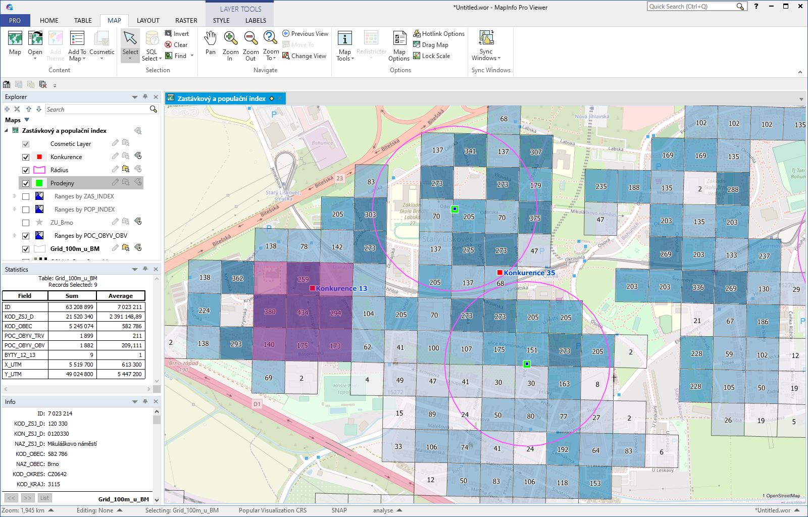
- MapInfo Pro Viewer allows you to open and view the MapInfo workspace (.WOR) and individual layers in MapInfo format (.TAB).
- Layer Control - the main panel, in which the user sets what he wants to display in a particular map (turning on/off the layers, labels, thematic maps and their parts, etc.
- Working with tables - in addition to the basic map view, the MapInfo Viewer allows you to inspect the attribute data through a table, incl. data sorting and filtering options. Spreadsheet data can also be easily copied outside the application, eg. to MS Excel.
- Working with objects on the map - user can list the attribute information about the object on the map in the Information window, select objects using the selection tools on the map or by writing a simple condition (eg select all municipalities with a population greater than 10000).
- Statistics - the sum and average values of all numerical attributes are displayed in the Statistics window for the selected objects. The user can simply "click" the area of interest on the map and MapInfo Viewer immediately calculates, for example, the number of inhabitants, the number of customers, the average number of orders or other indicators that the user has available in his data.
- In addition to the basic functions listed above, the application also allows cloning and synchronization of map windows, dragging the map to another application, exporting the map to PDF and other functions.
- Limitations of MapInfo Viewer
- MapInfo Pro Viewer does not allow the user to use any editing functions or save changes to the .WOR workspace. Launching and using add-on applications is not allowed in MapInfo Pro Viewer too.