Provided services
Addresses cleaning and geocoding
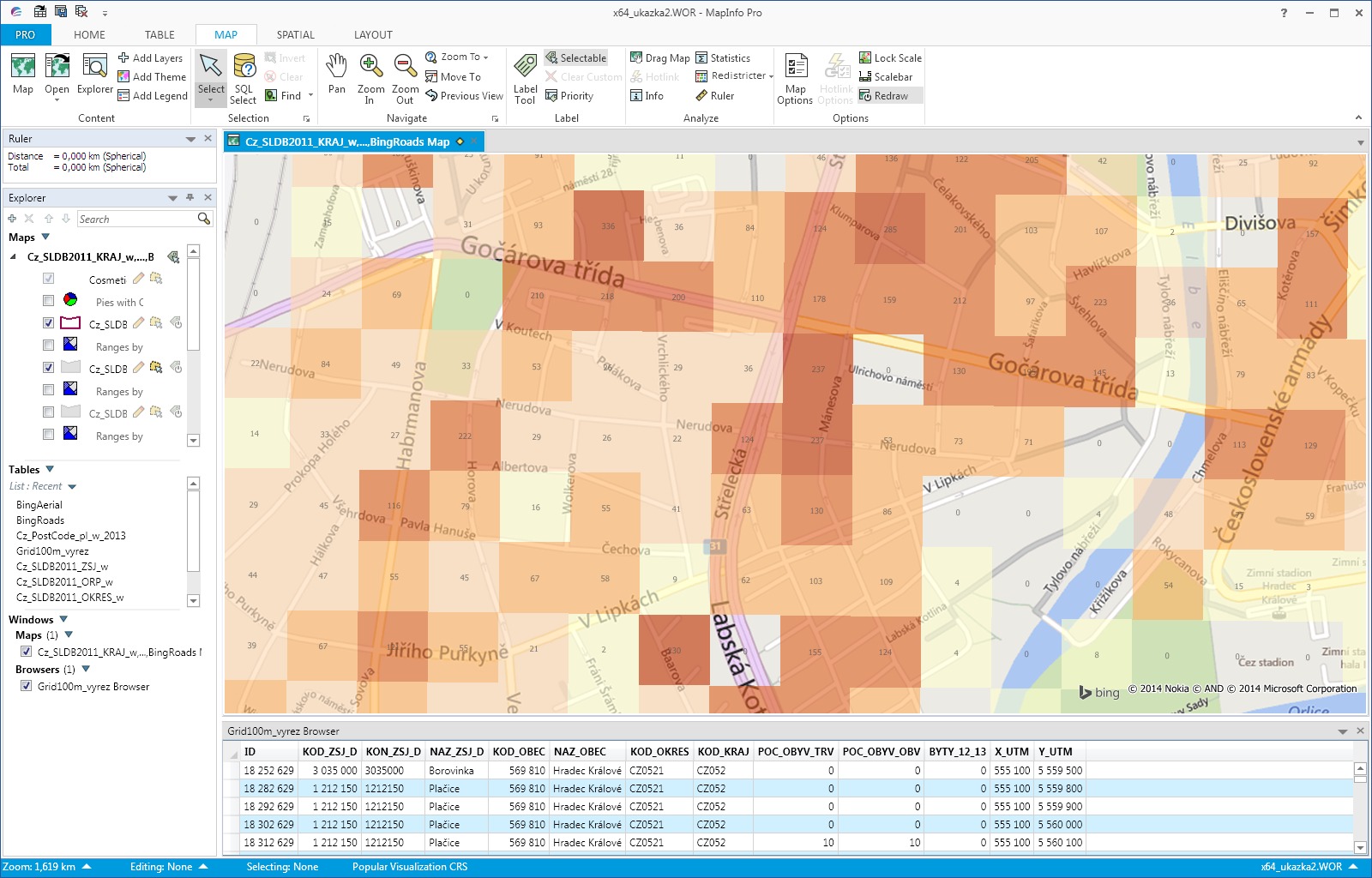
Geocoding is process whereby geographic coordinates XY are assigned to database record based on entered address. Result of this operation is point map layer which can be used in GIS applications for example geographical analysis of customers or sales force route optimization.
In addition to the standard delivery and implementation of software we offer our customers the entire process of addresses control and geocoding as a service, which may include:
- Automatic control of input addresses including addition of official names and missing parts of the address, f.e. municipality, minucipality part, postalcode, street or house numbers.
- Filling of geographic coordinates XY and creation of point map layer in WGS84 or JTSK coordinate system with possibility of translation to other systems. Every entry contains attribute with level accuracy level of geocoding and maximum deviation of coordinates in meters.
- Manual address tracing of records that were not geocoded automatically or were localized with less precision (on postcode area, municipality, etc.).

The price for the data cleaning and geocoding service of addresses depends on number of entries and range of services. Specific quotation will be sent on your request.
Geographic analyses processing
We are able to process variety of analyses for our customers that require high standard experience in the area of geographic information systems and available maps. The output can be a comprehensive reports, data or just a map in a variety of formats (pdf, jpg, png, tif etc.).
Forms of cooperation may include:
- Single or repeated processing of geographic analyses. Part of the project is identification of customer needs leading to define exactly how the result will be achieved and requested format (report, presentation, map and data).
- Collaboration with other partners (eg. consultancy firms etc.) where CSmap is part of partner project as a subcontractor and participates in the preparation and processing of map data and outputs.
- Custom creation or modification of map layers according to customer needs. The project may include input data collection, processing them (eg. geocoding, adding additional information) and finishing the output to the required output format.
The price for processing individual geographic analyzes and projects depends on the particular assignment. We will send you a specific quote based on your request or after mutual discussion and specification of your assignment.
Catchment area creation
We customize and analyze catchment areas, including the filling of additional information to catchment areas such as population, number of competing stores, number of customers, etc.
Typical tasks can include:
- Creating catchment area from a selected starting point by drive time (eg. Shop client) and create a situation report for the catchment area. The situational report may include the number of competing stores, the number of inhabitants and households, the housing and housing stock, the purchasing power of the population in the region.
- Creating catchment areas from/to several starting points by drive time or distance and subsequent analysis of catchment areas, incl. cannibalization analysis, to find white spots, calculating the potential of each area, etc.
Price formation catchment areas depends on their number and the accompanying analysis and work. We will send you a specific quote based on your request, possibly after mutual discussion and specification of the assignment.
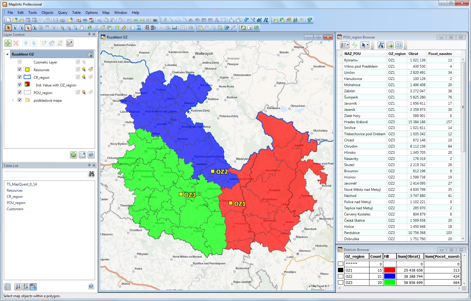
Creating regions and optimizing sales representatives routes
Creating or modifying sales representative regions and planning their routes may in some cases be more complex issue. Addressing this issue in the form of a service is optimal, especially when the merchant regions and the proposed routes remain relatively stable.
The subject of the project may be, for example:
- Designing the optimal number of sales representatives, including modeling their interest territories, on which they will perform their work, based on a variety of input parameters that the client will want to take into account when considering the analysis.
- Area sales representatives can be created based on the grouping of selected administrative units (eg. Postal code, city, basic administrative unit, etc.), Or by assigning individual customers, without any ties to the administrative organization of the country.
- Optimizing route sales representatives and export itineraries for the selected time period. For route optimization, it is possible to take into account a number of input parameters, such as the frequency of visits, time windows, length of visits to customers.
Price for optimizing routes and regions of sales representatives depends on the number of sales representatives and extent of the services. Prior to bidding, we usually propose to clients a personal meeting, discussing their needs and all the details of the assignment.
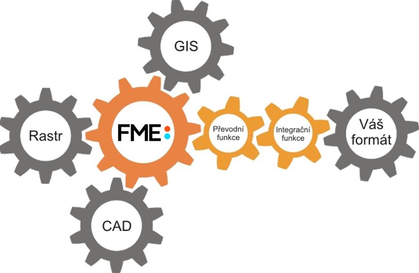
GIS/CAD formats conversions
If you need to convert and edit your data once, or you can convert it regularly, but do not pay for software and train staff, then we will be happy to assist you. All edits and data transfers for you can be processed as a service.
If you are already working with FME, but you do not know how to adjust your conversion, we can create conversion templates for you. We'll also help you get started with transfers right at your workplace.
We can process mainly these tasks for our customers:
- Convert dataset from A format to B format - transfer between GIS and CAD formats with the maximum possible level of information retention. For more information about supported formats, see the Specifications section for FME Desktop.
- Data structure modification - bulk edit of a database data and/or geometry. Most often, we resolve the migration of database data associated with other controls or operations.
- Data validation - data typically has to meet certain criteria created by your organization or your customers. The control processes are ready for you to set up.
Price for the processing of transfers depends on the particular assignment. Please contact us for price quotation.
Customized solutions development
Company CSmap s.r.o. has a team of experienced programmers with years of experience in developing map applications. We develop custom applications as well as customized solutions for individual clients.
The subject of development projects can be:
- Development of extended applications for geographic information system MapInfo Pro. These can be apps that simplify or automatize complex operations, but also applications that add new functionality to MapInfo.
- Development of standalone desktop applications according to needs and client input. These applications are typically designed to address specialized, customer-specific tasks. Part of the development is also the design and optimization of used map data.
- Development of server / web solutions according to customer specifications. It is very often a map web applications accessed through a web browser.
If you are thinking about developing map applications, please contact us.
Training and technical support
We provide professional training to customers to help them make the most of their purchased software and make it easier to use. You will be trained by trainers who have extensive experience both in training and using selected products. Of course, technical support is standard. We provide support to our customers through a technical support form.
We provide training for these products - MapInfo Pro, FME Form, FME Flow, MapInfo RouteFinder or GeoMarker Pro. We provide training on other products after agreement.
Our company offers two basic types of training:
- Training at the customer: This type of training does not limit the number of participants. Training content can be customized to the needs and discipline of the client. The term of the training is agreed between the client and our company. Customer, at its sole discretion, training content, on the recommendations of the supervisor shall determine the number of days. For training in its own premises, the customer provides all the equipment (training rooms and projector).
- Online trainings (Teams): The training is provided online through the MS Teams application and, with the client's consent, is recorded for later viewing. The number of participants is not limited, but we do not recommend more than 10 participants. The date and outline of the training is agreed upon individually and, as a rule, the training is provided on one date for participants from the same company.
If you are interested in any training and information about current dates, please contact us.
More information on FME product training More information about FME seminars